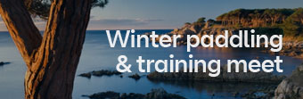
A great paddle, tides, an open crossing, history, the Giants’ Causeway and a cave ridden stretch of chalk cliffs to finish.
Rathlin Island is situated off the North East coast of Ireland. The tide is strong flooding in through the North passage to the Irish Sea. Some research on tides needs to be undertaken before starting this trip. Don’t assume that the tide turns at high water because it doesn’t. The tide turns and runs in a westerly direction at HW Dover, this is later than local high water. If you wanted to start earlier you could paddle up the inside of the Island to Bull Pt. This would also enable you to explore this stretch of coast line. At High Water Dover you will have the tide with you enabling you to paddle out on a heading for the main land. Alternatively wait on Rathlin until HW Dover and paddle straight out of the bay on a bearing for the main land. The tidal stream in Rathlin sound and the North Channel runs up to 6 kn on spring tides.
In order to get the most out of the tide we arrived at Ballycastle on the main land the day before the trip. We packed the kayaks and ferry glided over to the harbour on Rathlin Island. Rathlin is an L shaped Island with a small harbour in the knuckle of the bay on the southern side. A pub and a small shop, that we discovered was closed on Tuesdays. Yes, Murphy’s Law it’s Tuesday, so we will have to do without those treats we were looking for.
No one seemed to object to us camping but it is also possible to get B/B should you want it. An evening walk to the lighthouse almost made us alter our plans. It was tempting to circumnavigate the Island instead, but no, we will save that for another day. The lighthouse stands high on the cliff tops and you can look out over to the Mull of Kintyre, another cracking paddle. Too much to do, and too little time. We stood at the foot of the light house watching the tide swirl. As we walked back we discussed the tides in the area and came to the conclusion that it floods South through the North Passage for so long, because the Irish sea must be ebbing at a faster rate out of the Southern entrance.
Up early but a relatively late start! No point in fighting the tide. We left the harbour at 1130 am ferry gliding across the tidal stream. We had no particular landing spot on the North Coast, but hoped to end up off Ballintoy Pt. The wind blew force four to five in a North Easterly direction. Not normal for this time of year. As we left the shelter of the bay the sea state increased and found ourselves in areas of white water, with the odd wave breaking down the face. This forced us to brace for support, as the kayaks broached into the waves. We were surfing down the waves when possible and generally having a good time. As we approached the North Coast we could make out Sheep Island. This has a rope bridge connecting it to the mainland and the run from Ballycastle in an Easterly direction sticking to the mainland, would be an alternative to crossing the sound from Rathlin. Our transit lines showed that the tide was speeding up the closer we got to the mainland. Sheep Island was slipping past fast, we even increased our ferry angle but this made little difference. The wind was increasing and we knew that landings would be limited. In this wind the better option was to paddle along the coast to the head of the bay, have lunch and then paddle directly down wind crossing White park Bay to Bangor Head. Incas the wind increased, I knew we must judge this right, paddling down wind requires more skill. Often it can be the only option available in the stronger winds. We approached the headland after paddling downwind for three kn miles. Fortunately we managed to get close in before rounding the headland. This was lucky as the tide must have been running at four to five knots and the wind had increased to force six. The tide will turn soon and you wouldn’t want to be here with wind against tide so we pressed on despite the magnificent scenery. Efficient forward paddling down wind is an art in itself. You are not surfing in the true sense but you have to paddle at a reasonable rate concentrating on the bow of the kayak. As the stern lifts and the bow drops you lean forwards and at the same time put a little more effort into the stroke or alternatively speed up your stroke rate. Once you accelerate the art is in keeping the hull speed up. Feel the kayak. Sometimes you can overtake the wave in front by putting more effort into your strokes at the appropriate time. Continually trimming the kayak by using your body weight moving forwards and backwards is a must. No stern rudders if you can help it, try steering the kayak by edging and depending on the design of the hull you may be able to steer the kayak by leaning forwards and into the turn. As the wave passes sit up slowly to your normal paddling position, ready for the next wave.
We approach the Giants’ Causeway, we start to relax as since rounding the headland we are in the lee and the sea state has dropped. Looking up high on the cliffs you can see the rock formation changing. Basalt columns of rock start to appear high up forming the main cliff face. These columns can be up to 6m (20ft) high. This is an impressive area, a must for any kayaker. Columns and fingers of rock stick up making an impressive skyline. We explore large sea caves and high on the cliff you can see a footpath winding its way, following the contour lines of the coast. Strange, you would expect to see hikers and holiday makers walking the path. We had been told that you won’t miss the Causeway as it will be covered with sight seers. We paddled on and then we spotted groups of visitors on a low section of cliff. To my amusement they were even being bussed down the short track from the top of the headland.
As we approached we could see thousands of closely placed, polygonal pillars of rock. They form steps and ledges. Local legends tell us that the formation was built by giants as part of a road to Scotland. This low lying projection of rock forms the heart of the Causeway. The sun had finally come out and this helped to show off the shapes, as the top of the columns vary in shades of brown and the shadows highlight the ledges. All are surprisingly symmetrical. The columns are actually lava flows that have cooled and solidified. It’s fantastic to be able to paddle into an area like this and getting in for free too. We stopped for food and felt pleased to have experienced the other end of the causeway, visiting Fingels Cave on Stafa two years ago.
We pressed on to jokes of whisky tonight as we approached Bushmills. I had paddled this stretch of coast before so knew that Dunluce Castle would be coming up soon. This castle is perched up high on a peninsular and is the largest and most sophisticated castle on the North Irish coastline. Dunluce is Irish for fort. The oldest signs of human occupation, is a passage cut into the soft rock on the East side of the castle. This would have been used in the 10th century to creep out of the fort to get help when needed. As you approach the castle you will see a large cave immediately
under it. Today we are lucky, as the sea is calm enough to attempt a landing. One by one we land on a steep boulder beach. This is the time you are grateful for those keyhole cockpits. Time the landing. In on the back of a wave, off with the spray deck and out before the next wave hits. We carry the kayaks up a little as the tide is rising. This in itself is a two to three man job as the kayaks are loaded. We scramble up through the top of the cave surprising local holiday makers. Great! another attraction visited by sea. The Castle was built and developed between the 10th and 16th centuries. Although I’m not a castle person, you can’t help being impressed with the position and construction. It would have been easy to defend with the cave offering the option of bringing supplies in by sea. The entrance to the Castle would have been via a stone bridge. Two long stone walls run out from the entrance of the bridge forming a funnel. In times of war the cattle would be taken into the castle and as the enemy attempted to storm the entrance the cattle would be stampeded out crushing the attacking forces.
This is an ideal stop before the final push to Port Rush. Back on the water and we are getting tired. We paddle out and have two options straight across the bay to Port Rush or follow the chalk cliffs. It’s tempting to go straight across and it would be quicker. After a brief discussion the group splits some taking the direct route whilst three of us follow the coast.
Don’t take the direct route as this stretch of cliff is fantastic. You paddle into large caves with multiple entrances. There are arches and eyes through the rock both below and above the water line. Paddle into the caves and the sun shines down through the water reflecting off the chalky bottom. Turquoise blue and clear water! This stretch of coast would make a good day paddle, especially for the four star paddler. You could paddle out from Port Rush down to the castle and back. There is no tide to worry about but swells could be a problem. The local beaches are renowned for good surf.
In breezy conditions the day from Rathlin Island to Port Rush, should be led by paddlers of five star ability. If the group comprises mainly of three to four star paddlers, then this trip should only be done in wind speeds less than force three.
The total trip that day was 18 kn miles and had four parts to it.
- The crossing from Rathlin.
- The Giants Causway.
- The Castle
- The last section, an impressive stretch of chalk cliffs.
All in all a fantastic paddle. A must!

Kayak order form | Paddle enquiry form
Social media | Contact us | +44 (0) 1407 765550